Try Gofer
Gofer is an AI sourcing tool powered by iseekplant.
Tell Gofer what you need and it will help you create a job request and connect you with relevant local suppliers.
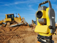
Drone Surveys Australia provides advanced aerial surveying and inspection services that deliver precision, safety, and efficiency across a wide range of industries. Using high-performance drones equipped with LiDAR and high-resolution sensors, we capture detailed data that traditional surveying methods often cannot reach. Our experienced team specialises in aerial mapping, infrastructure inspections, construction monitoring, and volume analysis for civil, mining, and environmental projects. We take pride in delivering accurate, dependable results that help clients make informed, data-driven decisions. Each project is managed by certified operators who uphold strict safety and compliance standards.
Gofer is an AI sourcing tool powered by iseekplant.
Tell Gofer what you need and it will help you create a job request and connect you with relevant local suppliers.