
Berriedale, TAS (11.8km)
Unverified
Also available:
Laser Levels
Total Station
Land Surveyors
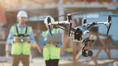
If you require a high-tech survey solution and don't have access to quality, up-to-date data, then drones are the perfect answer. Hobart companies employ these devices to create detailed 3D models and intricate orthomosaics that will provide what you need.
Also available:
Laser Levels
Total Station
Land Surveyors

Gofer is an AI sourcing tool powered by iseekplant.
Tell Gofer what you need and it will help you create a job request and connect you with relevant local suppliers.
Also available:
GPS Machine Control Systems
Pipe Lasers
Civil Engineering Consultants
Also available:
Electronic Locating
Ground Penetrating Radar
Drain Camera Inspection
Also available:
GPS Machine Control Systems
Land Surveyors

Also available:
UAV and Drone
Topcon Base Stations
Topcon GPS Machine Control Systems

Also available:
Surveyors
Land Surveyors
Aerial Surveyors
Also available:
Site Security Camera
Fauna Spotter Catcher
Revegetation

Also available:
Base Stations
Aerial Surveyors
Also available:
Total Station
Laser Levels
Land Surveyors

Concrete contractor software creates a solid foundation for any concreti...
Every business wants to make use of the best technology and create the b...